Only the roving Saint Columbanus the patron saint of motorcyclists and the fairy folk know how much I love Donegal! There has always been something ancient and mythical about the place. I learned to horse ride here as a kid and the best way to see Donegal as far as I’m concerned is mounted on either pony or motorbike. From mountain to coast the scenery is breathtaking but it’s best to see it in summer as the weather can be bloody frightful in winter. The rugged hinterland and dramatic headlands give Donegal a fierce beauty. Towering cliffs battered and torn by Atlantic storms shelter pristine coves and unspoilt beaches and remote inland valleys harbour wild deer and golden eagles. If you’re looking to gain the spirit of adventure then saddle up lads and get your ass to Donegal
Donegal Coastal Route
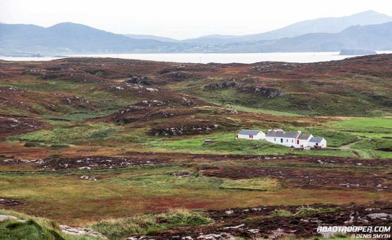
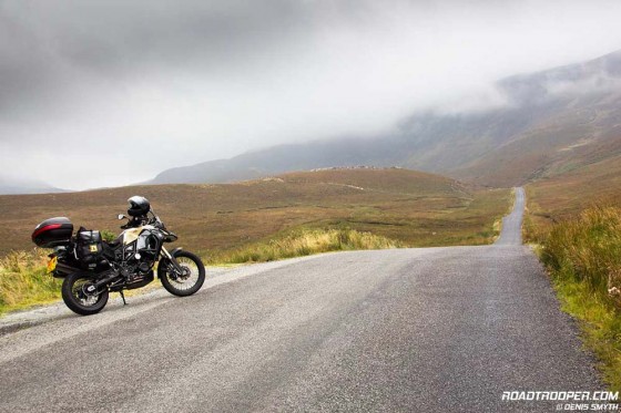
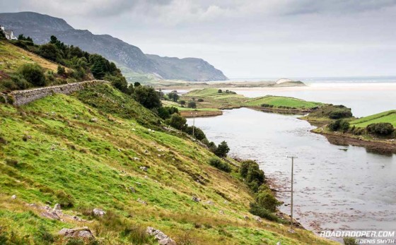
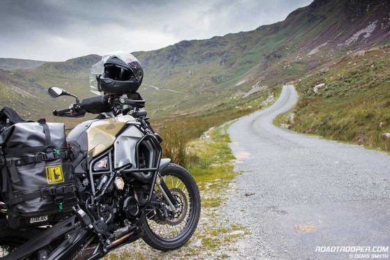
The full Donegal coastal route is 520km and its a solid 2 day ride and turns up some of the most dramatic coastal scenery in Europe so you’ll save yourself a lot of time by putting your camera in your tank bag. The Donegal coastline (WAW) route is spectacular but don’t think for a second that’s all there is to it. Mountains and highlands have always held a particular interest for me, and for my money Donegal has some great mountain roads offering a very different ride to the coast road. The wild, rugged and lonesome nature of Donegal mountain roads are nothing short of mythical, so if you get fed up with the tourist traffic on the coast in July or August you have an excellent alternative.
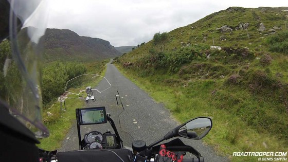
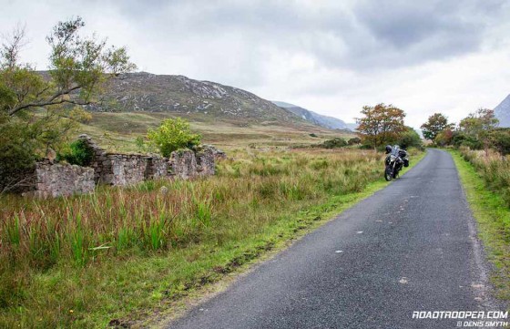
The Donegal highland route will bring you through the Glenveagh National Park via the R251 and the desolate R254 which skirt along the Derryveagh Mountains through mental scenery on par with riding through middle earth on the way back to the shire. This breathtaking National Park covers over 16,000 acres of forests, lakes and castles, and is home to a magnificent herd of tasty looking red deer and not so tasty golden eagles. Riding this road can only make you feel like you’re a very, very long way from home and will be one of your trips highlights.. Following the route south brings you into the heritage town of Ardara famous for it’s handwoven tweeds.
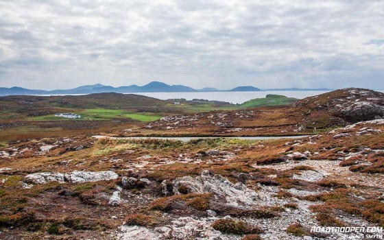
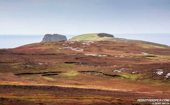
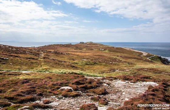
Officially the Wild Atlantic Starts/Ends just north of Derry on the border between the Republic and Northern Ireland which is where our journey begins. From Derry it’s a pleasant and smooth ride heading north-west on the R238 which hugs Lough Foyle on the left. From the seaside resort town of Moville (30km north of Derry) the R238 vears left and north towards the village of Mallin and the gateway to the Inishowen Peninsula. I’d typically start or end my trips to Donegal taking in the spectacular views on Malin Head, Ireland’s most northerly point. Enter Malin Head along the west side of the Wild Atlantic Way’s Inishowen Peninsula and continue to the tip called Banba’s Crown (named after a mythical Irish queen). “The Tower”, as it’s known locally, was built by the British Admiralty in 1805 as a Napoleonic lookout to help defend against possible French attack. During World War II, the Irish Government allowed the British Government to site two top-secret radio direction finders on Malin Head. The RDF equipment was used to monitor U-Boat and aerial activity in the North Atlantic, after the war the site became a weather station. There is usually an industrious lad up by the tower selling coffee and cakes if ye need an energy injection.
Looking north from this point and you’ll see the islands of west Scotland on a clear day. Beneath these turbulent waters there are more ocean liners, ships and German U-boats sunk off this stretch than anywhere else in the world thanking to the weather and the madness of man. Heading further south along the coast towards Buncrana there’s an interesting fort you might want to visit. Fort Dunree has a military museum with special emphasis on coastal artillery and the military history of the north west.
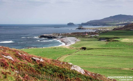
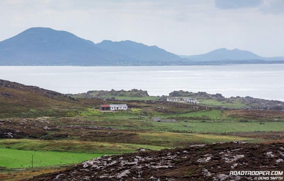
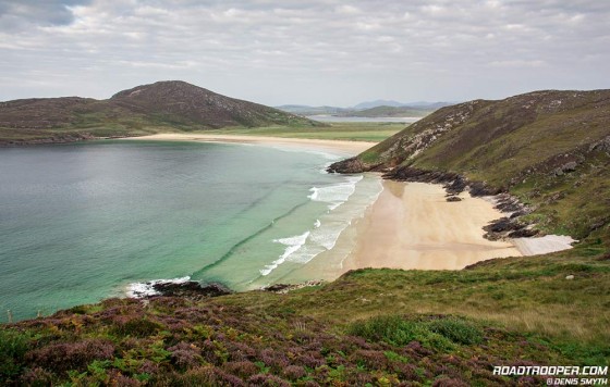
Heading south along the downloadable WAW route there’s the Doagh Famine Village (POI) which is worth a visit before the road turns north at Letterkenny and onto the Fanad Peninsula one of the best stretches of road in Europe. The Fanad Peninsula and neighbouring Rosguill Peninsula have some of Europes finest seascapes. Magnificent pristine golden beaches are framed by a mix of rolling farm and heathland, threaded by empty roads giving panoramic views of Lough Swilly and Sheephaven Bay.
Just north of Letterkenny you’ll pass the seaside heritage town of Rathmullan on the shores of Lough Swilly with sweeping views across the lough to Inch Island and Buncrana. From here the R268 coast road will progressively run riot on your optic nerves as it runs high along the cliffs above Lough Swilly before dropping back down to Portsalon Beach on Ballymastocker Bay. Portsalon Beach is reportedly the 2nd most beautiful beach in the world and is best seen from the viewing point at the hillcrest as you ride in from the south on the R268. If you get here in good weather you’ll find it hard to argue it’s claim of one of the worlds most beautiful beaches.
Following the route north the next stop off will be Fanad Head lighthouse perched on a rocky outcrop on the western shore of the Peninsula and was voted the world’s 2nd most beautiful lighthouse after Lindau Lighthouse in Germany. Not sure why Irish beauty spots keep coming in 2nd, but it’s still worth a look. Fanad Head is part of the Donegal “Gaeltacht”, the name given to the Irish-speaking areas of Ireland. Here 75% of the people speak Irish but don’t be worried, they all speak english too.
From the lighthouse car park you can stroll along the headland to spot the high waves and some of the Wild Atlantic Way’s most rugged stretch of coastline. With the backdrop of the lighthouse its a classic photo opportunity. Just make sure the sea fairy’s don’t drag your ass out to sea on a high wave..
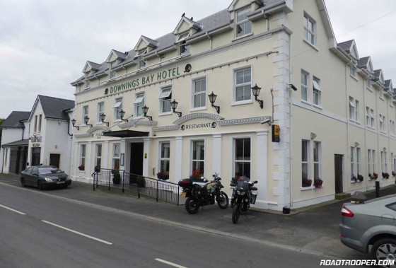
The Gaeltacht village of Downings
Continuing along south you’ll come to yet another gloriously pretty beach at Ballyhiernan Bay before heading out onto Rosguill Peninsula. The road around Rosguill Peninsula is known as the Atlantic Drive and from Mulroy Bay to Sheephaven Bay it’s an exhilarating ride with outstanding views of rocky headlands and white sandy beaches around every hairpin bend. On my last ride along here in 2014 I spent the night in the Gaeltacht village of Downings which is the base every autumn for launching game fishing charters in search of giant bluefin tuna. If like me and you prefer a quality room a very short distance to both bar and restaurant I’d highly recommend the Downings Bay Hotel by Sheephaven Bay. Downings Hotel has a proper quiet friendly bar serving simple good food.
If you fancy a stroll here have a wander down to the harbour and have a look at the seven ton naval gun salvaged from the wreck of the Laurentic, a liner that went down just off the coast after hitting a German mine in WW1. More than 300 sailors, mostly Canadian when down with the ship as well as 3,000 bars of gold bullion.
Don’t forget of course there are any number of top class places in Donegal to get your head down after a long day in the saddle and a few pints.
Heading South – Glenveagh National Park
From here you can choose to head south to Adara via the coastal route. Or mix it up a little and head for the hills on the optional route through the Glenveagh National Park. Honestly, this is a tough choice to make as each routes are outstanding in their own way. If you can your best option is to ride both as a loop or plan a return.
Adara is worth a stop if you’re feeling the cold and fancy a wooly aran jumper and it’s famous for it’s hand woven tweeds and which you can see being made on weavers looms in a couple of the shops. If you fancy staying in Adara overnight The Nesbitt Arms Hotel is biker friendly and has safe parking for your motorbike. From Adara you have a choice of following the official WAW route south over Glengesh Pass which gives superb views of Loughros Beg Bay and has a couple of enjoyable hairpins near the summit.
Taking my alternative route on the hunt for more lonely roads will bring you out towards Maghera Strand about 10km south west of Adara. This is a lovely stretch of road past oyster beds along the beautiful Maghera beach.
Passing the waterfall the road rides up a one track road through the majestic Granny’s Gap, be sure to stop on the summit as the views back down this valley are top class.
Slieve League Cliffs
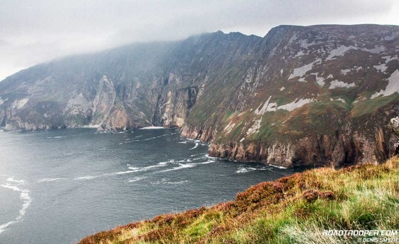
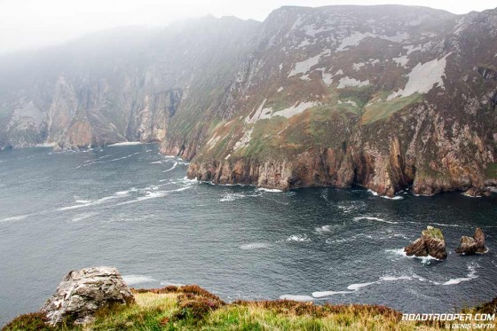
This route will rejoin the traditional WAW route at Glencolmcille on e of the western most points of Donegal. From here it along the coast to the mind numbing Slieve League Cliffs which beat the Cliffs of Moher in height and rival in majesty. Swooping down from the mountain of Slieve League, these towering precipes are among the highest sea cliffs in Europe.
From the crowning point on the cliffs, it’s a staggering 609 meter (1,998 feet) drop into the unforgiving Atlantic Ocean below. These bad boys are twice the height of the Cliffs of Moher, and as of 2014 during my last ride to the Slieve League Cliffs they were still free to access unlike the money generating tourist trap that the Cliffs of Moher have become.
There is a car park at the bottom with a gate blocking the road to the top viewing point as camper vans and coaches are not allowed up the final stretch, but motorcycles are. So just open the gate and ride on. I’m not sure whats more enjoyable at this point, the views along this clifftop road or watching the overweight cattle rolling off the coaches and struggling up the steep one track road.
Either way the ride up will render you speechless then slap you senseless as you reach the summit. This is a good spot to schedule a coffee stop as there’s usually a van here selling coffee and cakes as well as the obligatory Aran sweaters, chocolate leprechauns and defibrillators for the coach crowd. Trust me, do not miss an opportunity to ride up here, it’s definitely a POI for the bucket list.
Fishing Port of Killybegs
Riding on south brings you through the deep sea fishing port of Killybegs which is a good place to grab a stunning seafood lunch win one of it’s many seafood eateries. Just south of Killybegs it’s also worth your while to ride along the peninsula along McSwynes Bay and out to the lighthouse at Saint John’s Point. From there it’s a quick run into the county town of Donegal. Translated, Donegal means “Fort of the Foreigners” after the Vikings who built a garrison here in the 9th century, without asking or applying for the appropriate visas I might add, cheeky bastards. Heading south it’s a 30km/half hour ride to the seaside holiday town of Bundoran, the most southerly town in County Donegal. This is a very busy holiday town as it also has a stunning beach now even more popular as a destination for professional surfers. There’s great craic to be had in this town and it’s worth spending the night, but it will be necessary to book a hotel well in advance.
Read Next Post – The Wild Atlantic Way for Bikers – Sligo & North Mayo »


Thank you Denis for this series on the WAW – a friend and I are now planning on riding this in June, those sections that we can do in the 7-10 days we have available.
Great to hear you’re finding this series usefull and there is plenty more to come. Finding the time to finish it is a problem for me but hopefully I’ll get the full route posted before your trip in June. I’m sure you will have a brilliant time. The latest post is now online – Sligo & North Mayo
Rgds,
Denis
Hi Denis, All,
Last week (in Glorious sunshine) myself and the missus did the WAW from Rosses Point, Sligo to Cushendall, Co. Antrim (Causeway Coastal Route).
Had an absolutely fantastic time I had no idea Donegal had so many world class beaches! I have been to Donegal hundreds of times and never seen scenery like this, was really breathtaking. The route took much longer than expected because almost every corner we went around we had to stop for a photo.
2 points of interest for this site…
The Nesbitt Arms Hotel in Ardara was very motorbike friendly and provided secure parking (this is not offered to cars).
The Greencastle > Magilligan Ferry is only £8 return for motorbikes.
All the best,
Dan
Hi Dan,
Great to hear you had a good ride. It’s hard to beat the beaches in Donegal for shear beauty when you catch ‘em on a sunny day.
Cheers for the info, it’s alway good to know of a biker fiendly hotel. I’ll update this post and put The Nesbitt Arms in for others following the route. With a bit of luck I’ll have a chance to visit The Nesbitt Arms later in the year myself as I’ll be heading up that way again in September..
Safe riding,
Denis
Hi Dennis, no gate any more to Slieve League Cliffs just ride straight on up, looks like the road has been resurfaced recently
Cheers,
Paul
Cheers for the update Paul.
There was some sort of construction going on thet last time I was up there, maybe that was the purpose of the gate.
Hope your enjoying the trip and the weather is being kind..
D
Hi Denis
Just returned (mid June) from a solo ride over to Donegal after having read your report and downloaded the route for the Donegal section of the WAW. I have rode in Donegal before but your route guides allowed me to explore the county even further.
Was stopping near the top of Donegal so did daily rideouts rather than follow the WAW.
I recommend a circular route around Inishowen starting from Greencastle taking in Malinhead, Mamore gap and Inch island and then returning on the R238 with the views of Lough Foyle on your right shoulder.
Terry
PS
the gate was back on at Slieve League Cliffs.
Cheers for the update and circular route Terry,
I hope to be up in Donegal myself in Sept and will give it a go..
D