Assuming you’re legally and physically capable of riding a motorcycle after a night in Matt Molloy’s in Westport (see previous post) this next stretch of the WAW brings you south towards Clifden and the mythical landscape of the Connemara National Park in Galway.
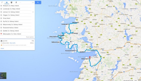
South Mayo/Galway to Clare Route
Louisburgh Féile Chois Cuain
Head south and the road weaves through to the pretty town of Louisburgh. Beware riding thru here during the May Bank Holiday Weekend or you’ll get caught up in the Louisburgh Féile Chois Cuain which rolls into town. This consists of musicians arriving from all over the world making music and a general nuisance of themselves whilst attracting herds of tourists suffering from a nasty dose of “the craic”.
Reek Sunday
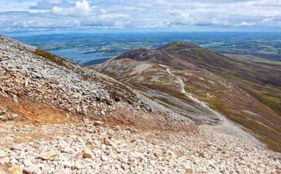
Also expect very heavy traffic in the Westport area around the last Sunday in July as 40,000 crusafix and stick wielding religious fanatics make their way up Croagh Patrick for the annual barefoot pilgrimage known as Reek Sunday.
This event is of course in direct violation to a decree by the Islamic State who find crucifix waving barefoot hikers on a cold wet mountain at the arse end of the European continent an insult to the their own rather sensitive beliefs. The leader of this mountain worshipping barefoot Christian cult, Paddy O’Shenanigan in response to the Islamic States anti-crucifix decree stated “If one o’ them gobshites tries taken me crucifix I’ll shove this here pitchfork up his fecken hole”. Negotiations continue, but due to the escalating tensions in the area it’s probably best avoided at the end of July.
Clew Bay
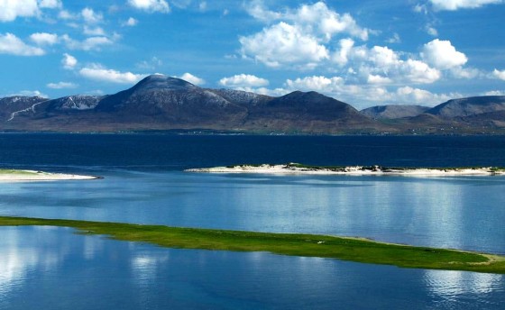
Leaving Westport south on the R335, the splendour of Clew Bay dominates the scenery on the right. If you have the time and inclination it’s worth making your way down the White Strand Beach, on a sunny day when the tide is out it’s hard to imagine a more beautiful place.
Heading for Killary Harbour
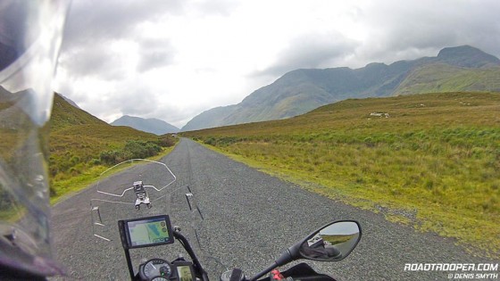
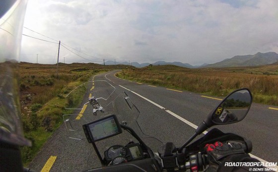
Following the R335 south heading for Killary Harbour the road climbs up through the beautiful Delphi Valley which then lets you barrel through the lakes of Doolough Pass.
This whole stretch of road, always a highlight for me, is a piece of pure motorcycling heaven as the views of the haunting Mweelrea Mountains do a fine job of making you feel insignificant to the passage of time. Check out the video below which was taken on my last ride here in Sept 2014, unfortunately I got caught up in a classic car rally, usually there’s not so much traffic. It has to be said though, fair play to this well organised club as they were all very accommodating in letting us lads on the bikes to overtake them as safely as could be managed on a narrow road.
Killary Fjord
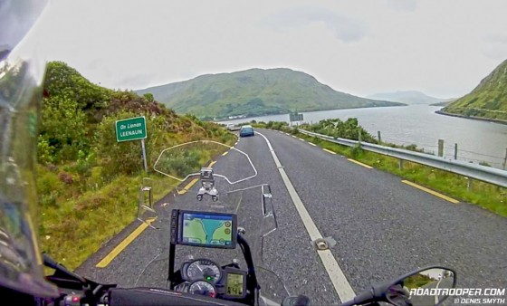
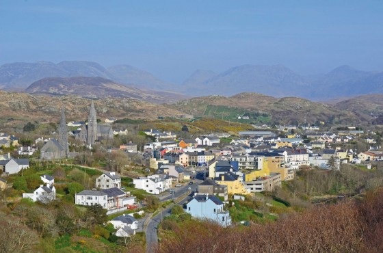
Dropping down from the Doolough Pass the R335 dumps you into more wonderful views along Killary Fjord – An Caoláire Rua in Gaelic and 1 of only 3 fjords in Ireland, Lough Swilly and Carlingford being the other two. From here you join the N59 and those on sportbikes will gratefully enjoy a smoother ride. Killary Harbour is in the heart of Connemara and forms a natural border between counties Galway and Mayo and the village of Leenane on the harbour shore is a good spot to schedule a coffee break before the ride out to Clifden.
For the ‘ol film buffs among ye Gaynor’s Pub in Leenane was where Richard Harris played “Bull” McCabe in the 1989 film “The Field”, and in real life the staff serves up a great pint of the black to go along with a toasted sandwich.
Just after Leenane the N59 heads inland and south where you have a choice of directions. If you’re running short of time keep the N59 will bring you along Kylemore Lough and Abby which is a cracking good run and there are some brilliant panoramas along the N59 all the way out towards Clifden.
Renvyle Peninsula Connemara Loop Road
If you have the time however I’d recommend you stick with the official WAW route which brings you out onto the Renvyle Peninsula Connemara Loop road – take the road to Tullycross at the T-junction 7km after Leenane. Both routes are in the “Wild Atlantic Way, Co. Galway Full Coastal Route” in the GPS download page »
Ride from Westport to Clifden
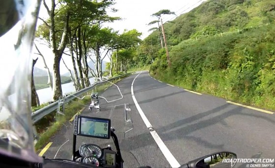
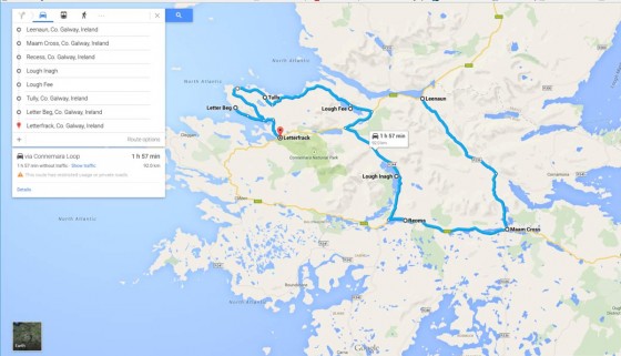
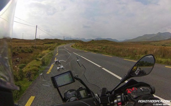
If you do have a full day to ride from Westport to Clifden then I’d highly recommend this route from Leenaun to Letterfrack which will take in the best roads of the Connemara Loop area. The road out along the peninsula to Letter Beg may not be to the taste for some bikes as it’s a dead end boreen, but it’s the kind of road I live for ![]() On this route there is also a stretch of road (R334) which runs along Lough Inagh and the Inagh Valley, this has got to be one of the most scenic roads in the world, there’s a photo opportunity at every turn as the road winds its way through the majestic heather covered mountains and around the picturesque lakes. Anybody who thinks the the Wild Atlantic Way is just about the coast is mistaken, and this road is proof of that.
On this route there is also a stretch of road (R334) which runs along Lough Inagh and the Inagh Valley, this has got to be one of the most scenic roads in the world, there’s a photo opportunity at every turn as the road winds its way through the majestic heather covered mountains and around the picturesque lakes. Anybody who thinks the the Wild Atlantic Way is just about the coast is mistaken, and this road is proof of that.
View this route on Google Maps »
Heading for Renvyle Peninsula
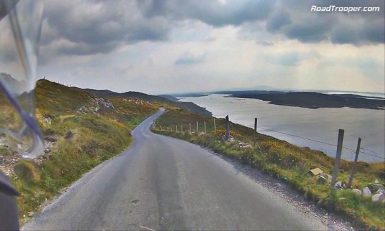
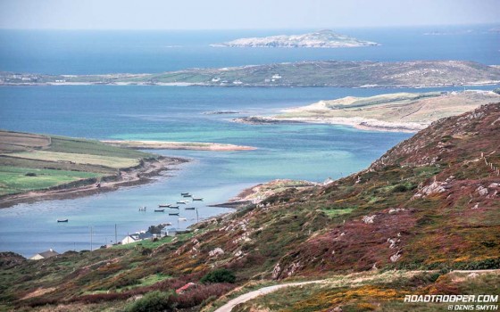
The Connemara Loop road out to Renvyle Peninsula is a marvellous ride through remote peat bog land and mountains to gut wrenchingly beautiful coastal vistas. It’s very easy for me to spend 2 hours out on this peninsula alone to cure my spirit of the worlds woes and if fair weather is on your side then it’s a treat to be sure. I’ve always loved the more remote areas of Europe – from southern Sweden to northern Finland, the upland trails of the Rhone-Languedoc-Roussillon and Provence Alps, the Basque Pyrenees, Navarra and countless other places – I’ve loved them all. But Connemara has a light and sole like no other and if it were up to me I’d spend a full week simply pottering about this part of our wonderful world soaking up the landscape, villages and people.
The Connemara Loop will rejoin the N59 to Clifden at Letterfrack, then past Letterfrack hang a right towards Cleggan. The Harbour at Cleggan is primarily used for fishing vessels but it’s also the ferry dock to Inishbofin if you fancy a trip to another time zone, circa the 1930′s. If not follow the route around by the lough at Aughrisbeg and back along the coast to Claddaghduff and take a right by the church where ye’ll find a little harbour. If the tide is out you’re in for a bit of fun as you can ride across the beached bay to Omey Island, but watch the tide or you’ll have to do a Jesus imitation and ride on water to get back.
Sky Road
The next fun stretch of road before hitting the musical pubs of Clifden will be the Sky Road. Follow the road from Omey Island/Claddaghduff and rejoin the N59 taking an almost immediate sharp right turn onto the Sky Road, this was suffering from a lack of WAW sign posting in 2014. There is a sign for the Sky Road, but it’s about as much use as an ash tray on a motorbike as like so many of Irelands signposts some bastard has cunningly hidden it around the corner where nobody can see it. I can only assume it’s camouflaged location is in the hope it won’t be stolen by deviant teenagers playing the old game of “fearg na ghallaibh” – Irish Gaelic meaning “piss off the foreigners”. If you do manage to find it you will be rewarded by some spine tingling views before swooping down into Clifden in search of the bastard who hid the fecken sign for the Sky Road.
Clifden
Clifden (Irish: An Clochán, meaning “stepping stones) is Connemara’s largest town and often referred to as “the Capital of Connemara” but the only one who really thinks that is likely to be the town mayor and the local tourist office ![]() . The town has a fair bit of interesting history about it even though it only came to being in the early 1830’s. The town was nearly wiped out before it had a chance to grow when the famine started in 1845. The town first gained notoriety when British aviators Alcock and Brown made the first non-stop transatlantic flight in June 1919 flying a modified World War I Vickers Vimy bomber from St. John’s in Newfoundland. Unfortunately this great feat was largely lost on the locals at the time who’d never heard of Newfoundland and were more interested in why the lads had dumped a perfectly good aeroplane in the bog outside of town.
. The town has a fair bit of interesting history about it even though it only came to being in the early 1830’s. The town was nearly wiped out before it had a chance to grow when the famine started in 1845. The town first gained notoriety when British aviators Alcock and Brown made the first non-stop transatlantic flight in June 1919 flying a modified World War I Vickers Vimy bomber from St. John’s in Newfoundland. Unfortunately this great feat was largely lost on the locals at the time who’d never heard of Newfoundland and were more interested in why the lads had dumped a perfectly good aeroplane in the bog outside of town.
By 1905 Clifden saw Guglielmo Marconi build his first high power transatlantic long wave wireless telegraphy station four miles (6 km) south of the town to minimize the distance to its sister station in Glace Bay, Nova Scotia. This was the first point-to-point fixed wireless service connecting Europe with North America. A local gentleman called Paddir O’Callaghan (aka POKO) was the first Irishman to talk the to New World wireless when he received a call from another gent in New York who unceremoniously tried to convince poor Paddir to buy a house insurance policy in a sure sign of things to come.
Unfortunately Clifden had a hard time of it again in the 1920’s, first with the burning of the town by the Black & Tans during the war of independence. Clifden was burned again by anti-treaty Republicans following a scorched earth policy, at this stage poor Paddir O’Callaghan was regretting telling that yank to feck off with the home insurance policy. The Republicans in a brilliant flash of foresight also set fire to Guglielmo’s telegraphy station which was stupidly seen as an “English concern”. After it’s destruction the station was relocated to a newer station in a less turbulent Wales. By one reckoning, the station’s closure following the Republican attack caused an estimated 1,000 people to lose their livelihood – not Irelands finest hour. The Irish civil war was a bitter one, and to this day few people are willing to talk about it. Even my own grandfather would shake his head and look away when I’d ask about it, some things are best left forgotten I guess.
Continuing our two wheeled journey south along the WAW the next spot worth a ride is out to Bunowen Bay on the Slyne Head promontory simply for the typical rocky landscape views of Connemara before rejoining the WAW route south on the R431. The Gulf Stream sweeps across Slyne Head which has created Coral Beach just past Ballyconneely where the white sand is made entirely of coral. For the fish lovers you might be interested in “The Smokehouse” on Ballyconneely harbour where they prepare smoked and marinated wild and organic farmed salmon in addition to their cold smoked tuna which I have to admit is a personal favorite. You can take a smokehouse tour which as an ex-chef myself I found interesting when I took the tour a few years back. Since then I’ve been getting my “fix” as I ride out the recession on the Isle of Man by buying online »
The ride south on the R431 you’ll come to the coastal village of Roundstone. A few km just south of this town the road opens up some excellent views, keep an eye out for the sign and T- junction where you can take a bridge to the right out to the island of Inishnee which offers some wonderful views on a clear day. You’ll also find yourself well and truly in the Galway Gaeltacht so many of the signposts will be in Irish or both English and Irish.
Aran Islands
The next town south you may want to take note of is Rossaveal where you can take a day trip out to the Aran Islands. A trip out to Inis Mor is without doubt worth the effort. The ferry only takes foot passengers which makes it a bit of a hassle with bike gear unless you have lockable panniers, if not your best bet is to book a nearby B&B where you can leave your motorbike and gear. Alternatively you can stay 40km down the road in Galway, any Galway hotel or B&B there will help you organise a mini-bus and a trip out to the Aran Islands. Remember however, during the tourist holiday season it’s far better to book this up front, you can negotiate this while booking your chosen hotel and then ring the hotel to confirm the arrangements again a week before arrival.
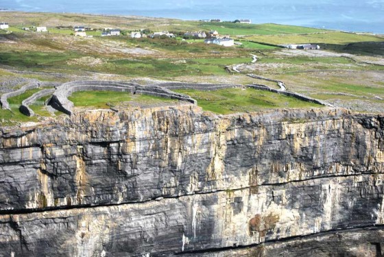
When you get to the island at the port of Cill Rónáin you can explore the island by hiring a bicycle or take a horse & trap or mini bus tour. The major sight to visit has to be the the Iron Age stone fort of Dún Aonghasa that sits on spectacular 300 ft cliffs and is one of the most magnificent Iron Age monuments in Europe. Today it sits right on the cliff but when it was origionally build it would bave been up to 3 miles from the coast. In summer months this isle is insanely popular so booking the ferry and a nearby B&B well beforehand is essential, book online here
Galway
From Rossaveal the WAW runs into Galway along the R336 with Galway Bay to your right. About half way you’ll ride through the fair coastal town of Spiddal. From there the R336 takes you into Galway but it’s not a road I’d be taking for two reasons. Firstly the traffic into Galway along this stretch is regularly a complete pain in the arse, in summer I’d sooner take a feisty kick in the arse than ride into Galway on this stretch of the R336.
Secondly, as far as I’m concerned I’d far prefer to ride through the bogland that lies to the north of Spiddal between Galway Bay and Lough Corrib. There are various backroads through this area into Galway, the easiest, and a fair pleasant way is on the L1320 that leaves Spiddal and rejoins the N59 (Clifden Road). Or you can ride through Moycullen Bog Heritage Area which would be my choice as it’s a wild and beautiful area mostly devoid of traffic.
For fear of turning this post into a typical travel guide for all and anyone I’m going to skip the speal on Galway itself as there is way too much to see and do in Galway for me to try and get it all in here. If ye want to stay here there is more than enough info on this town that you can find online for yourself or in printed form. I will warn you on one thing though, the traffic in and around Galway is a freaking nightmare at the best of times. The current population has long since outgrown the capabilities of the road structure. An intended ring road bypassing the city has ended in ceaseless arguments so there will be no end to the traffic anytime in the near future. If you can, try to avoid riding in or around Galway during rush hours and expect very heavy, slow moving traffic in summer months. Don’t be overly worried about this, comparing to big cities in Europe or the US Galway is actually fairly small with a population of 75,000, so negotiating from one side to the other in heavy traffic on a motorbike should only take you maybe 30-45 minutes depending on the route, less if you are used to city traffic and unburdened by big metal panniers.
For entering or riding around Galway to rejoin the WAW this would be my choice route on a motorbike, this lets me bybass much of the potential traffic and lets me either ride around the city of head in and down to the harbour via The Cladda or Salthill area:
View this route on Google Maps »
These days I’m not too keen on riding through or staying in big cities opting to stay in small villages where I can relax over a couple of pints with good food and accommodation at a fair price, safe in the knowledge that my bike is also safely tucked away. On my last trip along the WAW in 2014 I skipped around Galway and sayed in the County Clare village of Ballyvaughan just south of Galway City. Here you can find a couple of fairly priced places to get the head down after a facefull of food and drink and be well placed to get straight onto some cracking roads into the Burren region without the headache of Galway’s morning traffic mayhem.
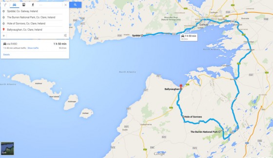
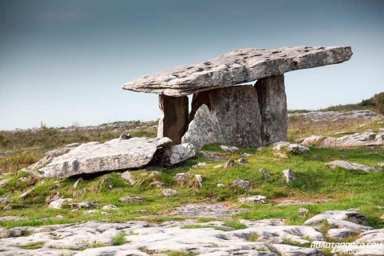
If you do decide to skip Galway City heading towards Ballyvaughan there is a marvelious detour inland (see map above) which will bring you through the stunning limestone landscape of the Burren. You’ll also have the oppertunity to stop off at Poulnabrone Dolmen (Hole of Sorrows on Google Map). Poulnabrone Portal Tomb is one of the most photographed megalithic monuments in Ireland and it’s not hard to imagine why. I’ll be covering the Burren, Clare and the Kingdom of Kerry in my next post.



Was down this stretch a couple of weeks ago.
Wot he says.
Stunning scenery and great ride.